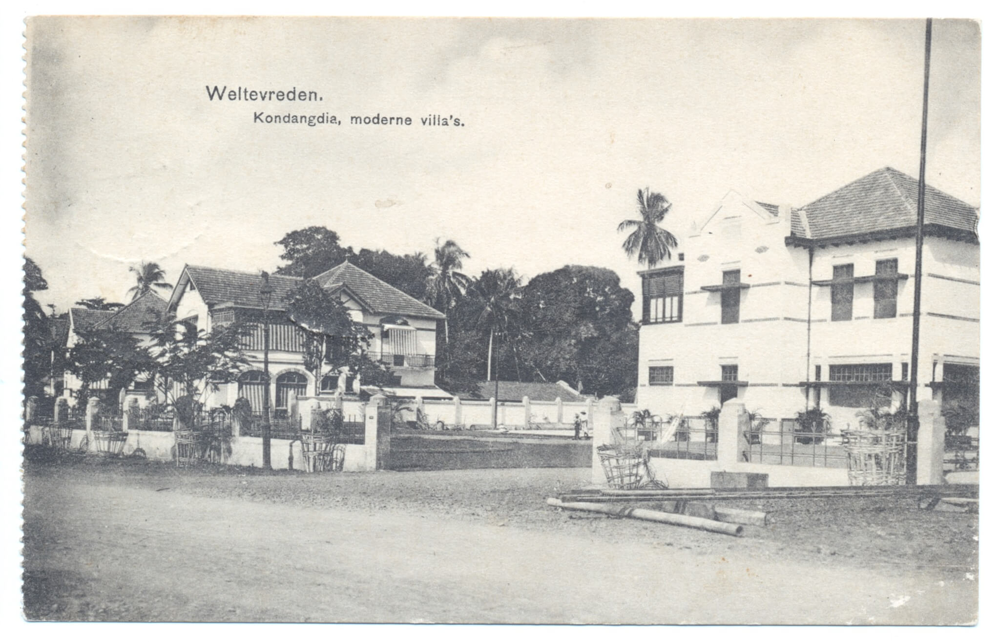
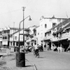
Newly built houses by De Bouwploeg on the southern side of the just constructed entrance to the new residential district of New Gondangdia (now Jalan Cut Meutia). These two-storey dwellings were located on the right side of the road when approaching from the train line, and the photographer stood in front of the Boplo (Bouwploeg) building, now the Mesjid Cut Meutia, which was under construction at the time when the photo for this Kolff & Co postcard was taken. Construction of these houses started in July 1911 and the first families inhabited these as from early 1912.
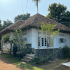
Wisma Mochamad Romly
The house on the right is now the site of Wisma Mochamad Romly on Jalan Cut Meutia 13, and was already a mess in 1946, then of the Marine Women’s Department (Marva). This house was designed by P.A.J. Moojen (1879-1955) who was one of the most renowned architects of De Bouwploeg. Houses of a similar design were already designed and constructed by Moojen two years earlier in Kramat (more on this soon). The house to the left is situated where today the KPBN office is located, the furthest house to the left is the site of today’s Sofyan Hotel. These two houses were most likely designed jointly by Moojen and other architects of De Bouwploeg. Sadly all houses on this postcard were demolished long ago. There is one original Bouwploeg house left on the northern side of Jalan Cut Meutia: the Bank Mandiri branch at Jalan Cut Meutia 16.
The Batavia/Jakarta City Council approved a plan in October 1910 to construct an entire new residential district on the grounds of the former lands ‘Gondangdia’ and ‘Menteng’. This was urgent as the city suffered from a general shortage of houses, although Menteng/Gondangdia was created mainly for the well-to-do European residents of Batavia/Jakarta. A commission worked out the plans and by 1911 the so-called N.V. De Bouwploeg was established and in charge of the development of the northern half of this district. This was named “New Gondangdia” and covered the area north of what is now Kali Gresik (the drainage canal between Jalan Moh. Yamin and Jalan Sutan Syahrir). Menteng was situated south of this canal. Construction started in July 1911 with the first 11 houses on what is now Taman Cut Meutia.
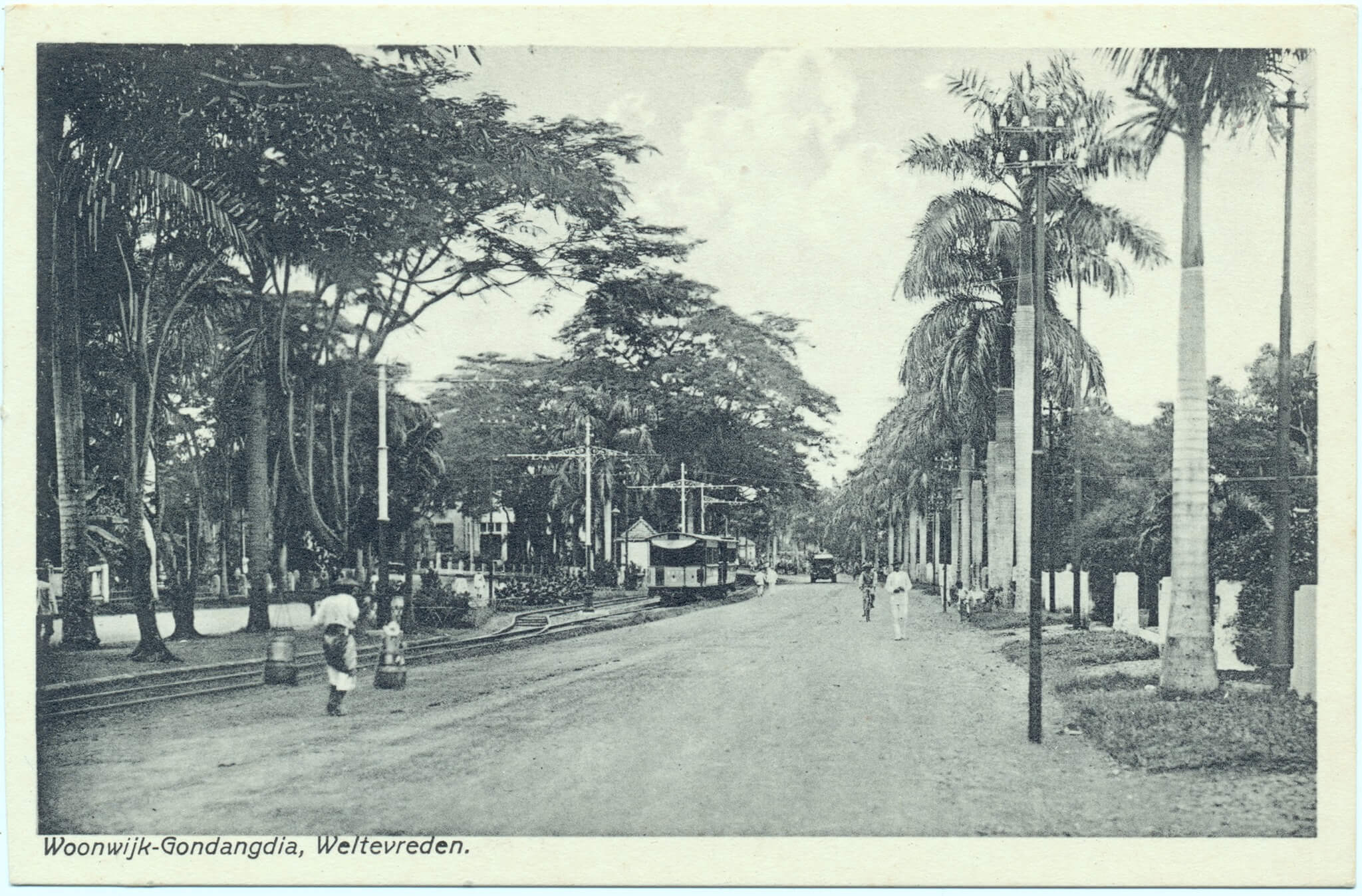
Gang Baroe Kondangdia
Beforehand this was a small dirt road called Gang Baroe Kondangdia and led to the nearby Kampung Baroe (Baru). However as from 1899 the new electric tram line from Tanah Abang to Tjikini (Cikini) ran through this kampung too. In 1911 the road was doubled to create a stylish ‘entrance’ to the new residential district, with the tram line in the middle, as we can see on this picture. The houses along this entrance all had two storeys and were designed by architects of De Bouwploeg, of which P.A.J. Moojen and Ch. P. Schoemaker were the most well-known.
Entree Gondangdia
Since the establishment of De Bouwploeg in November 1909 the company was based behind the Raad van Justitie (now Museum Seni Rupa dan Keramik) in Kota. In 1912 construction started of an impressive building for De Bouwploeg at the end of the Entree Gondangdia street, next to the train line. It is partly visible behind the trees in the distance, left of the tram. This postcard from Visser & Co dates from approximately 1920 and was taken from the corner of Menteng (Jalan Menteng Raya), Tjikini (Jalan Cikini Raya) and Oud Gondangdia (Jalan RP Soeroso).
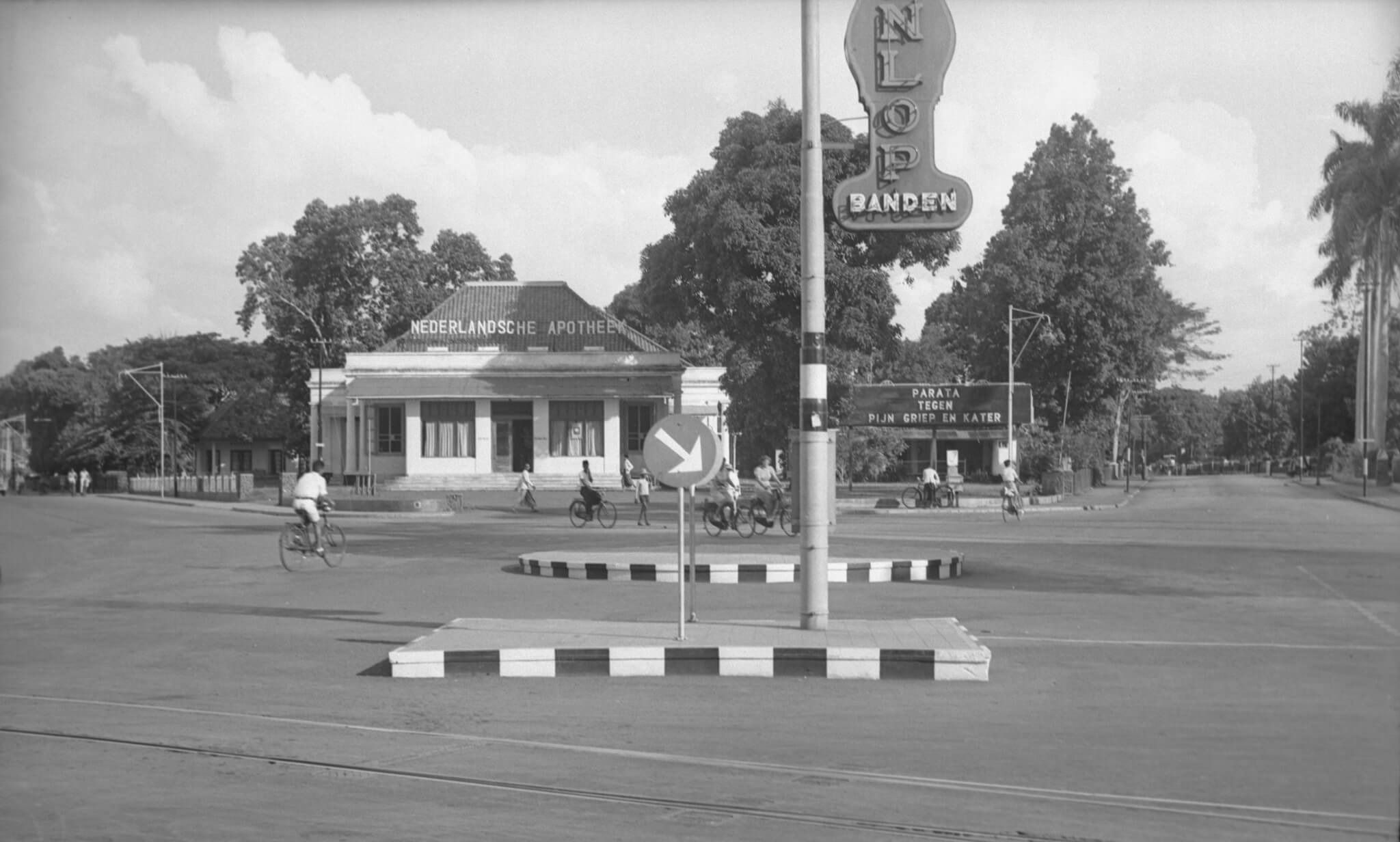
The intersection Simpang Lima at Cikini – Jalan R.P. Soeroso 1941
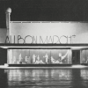
A unique view of a unique building that stood on this place until at least 1995. During a visit to Jakarta in 1995 I suffered from a tummy bug while staying in a guesthouse along Jalan Gondangdia Kecil. I went to this pharmacy to purchase some Norit and I remember it was still the old colonial era building. This photo from nearly 80 years ago was taken at the so-called ‘Vijfsprong’ where 5 roads came together: Oud Menteng (Jalan Menteng Raya), Tjikini (Jalan Cikini Raya), Oud Gondangdia (Jalan RP Soeroso), Van Heutszplein (Jalan Taman Cut Meutia) and Gang Pengarengan (this road no longer exists).
Nederlandsche Apotheek
We are looking south. Left of the Nederlandsche Apotheek (Netherlands Pharmacy) is Tjikini, to the right Oud Gondangdia. The sign near the drugstore says “Parata, against pain, flu and hangover”. At the front, partly visible, an advertisement for Dunlop tyres. Despite a usual busy intersection, we only see cyclists and pedestrians on this photo. On the site of the former apotik/drugstore is now the “Menteng Huis” with the Kimia Farma Pharmacy and a number of other stores. If any Jakarta residents can tell us more about when the old pharmacy building was demolished, that would be very helpful.
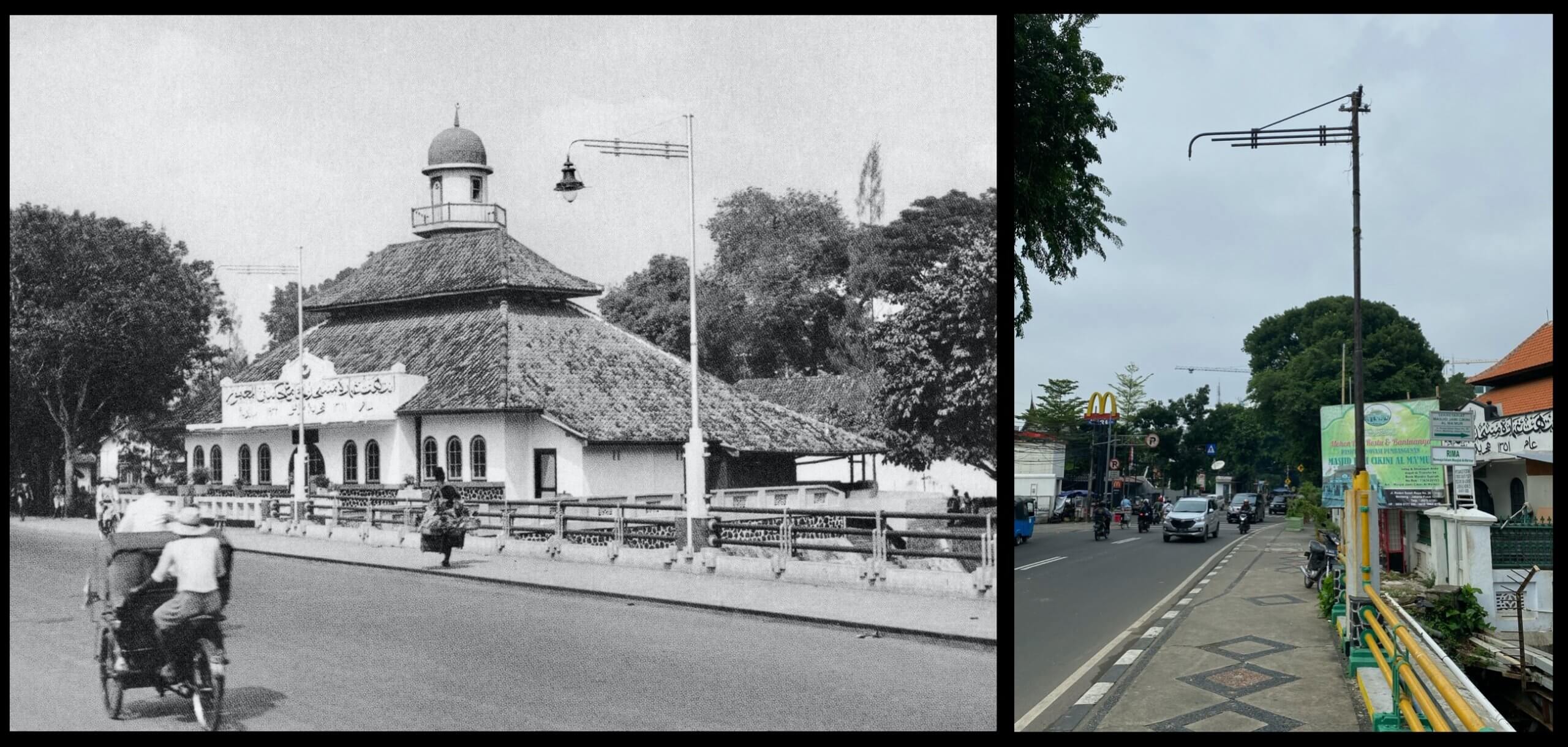
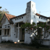
If you think our obsession for Jakarta’s history has reached worrying levels, then you might be right. Who else in the world would get so utterly excited by discovering colonial era relics from the time Jakarta was called Batavia, that we assumed would have all disappeared long ago? When we recently passed the Al Makmur mosque on Jalan Raden Saleh (formerly: Laan Raden Saleh) we discovered something unbelievable.
Street lamp
Thinking that all colonial era street furniture was removed decades ago, we noticed the remains of an original 1930s Batavia street lamp on the bridge next to the mosque. There are a few more on the other corners of the bridge too. The historic picture of the mosque on Jalan Raden Saleh and street lantern dates from 1941. If you know of any other old street lanterns in current day Jakarta, please let us know!
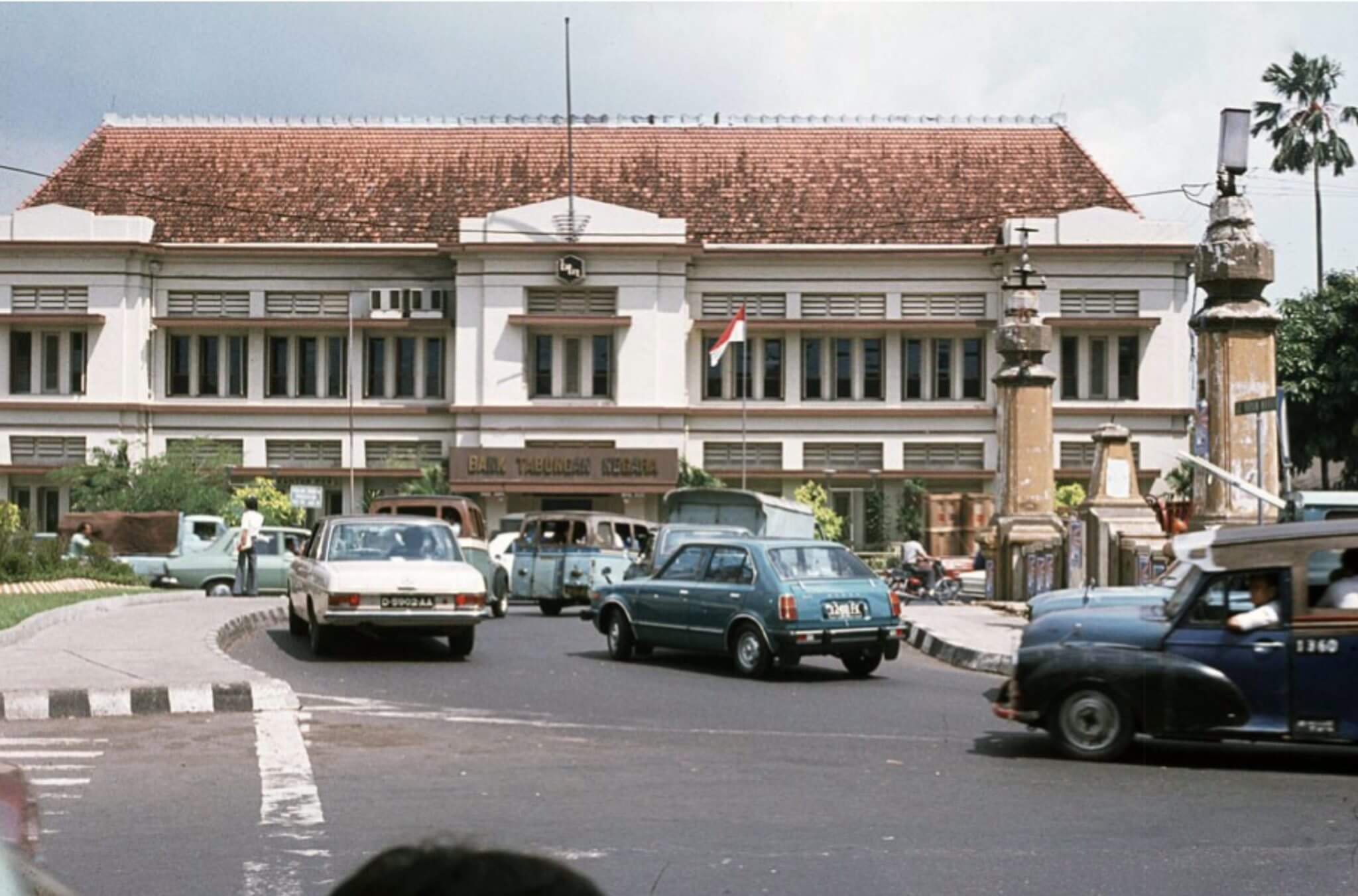
Bank Tabungan Negara (former Postspaarbank) at Jalan Gajah Mada 1980
Cars making a U-turn at the Harmoni intersection in front of the Bank Tabungan Negara 40 years ago. At that time the building was still in exactly its original state, before the newly built high rise headquarters were built behind this building in the 1990s and two parts of the front facade on the ground floor were removed to allow cars to enter and exit the grounds through the old building. These days there are basically two big gaps in front of the historic bulding.
Tjokin Kjokoe
It was since 1927 owned by the Postspaarbank (Postal Savings Bank) who modernised it in 1930. During World War II (1942-1945) the bank was named Tjokin Kjokoe. Between 1945 and 1947 it had two entrances: to the left “Bank Tabungan Pos” for Indonesian languaged bank account holders, to the right “Postspaarbank” for bank account holders with a Dutch background. In 1950 it was officially renamed as Bank Tabungan Pos, until it obtained its current name in 1963. Since 2017 the name “Postspaarbank” has returned on top of the red roof of the building again.
Henk van Rinsum
The photographer in 1980 was Henk van Rinsum. He stood in front of the former Hotel des Galeries on the corner of Jalan Hayam Wuruk and Jalan Juanda. Outside this photo to the left, one would be able to admire former society De Harmonie, which entered its last 5 years of its existence; the building was sadly demolished in 1985.