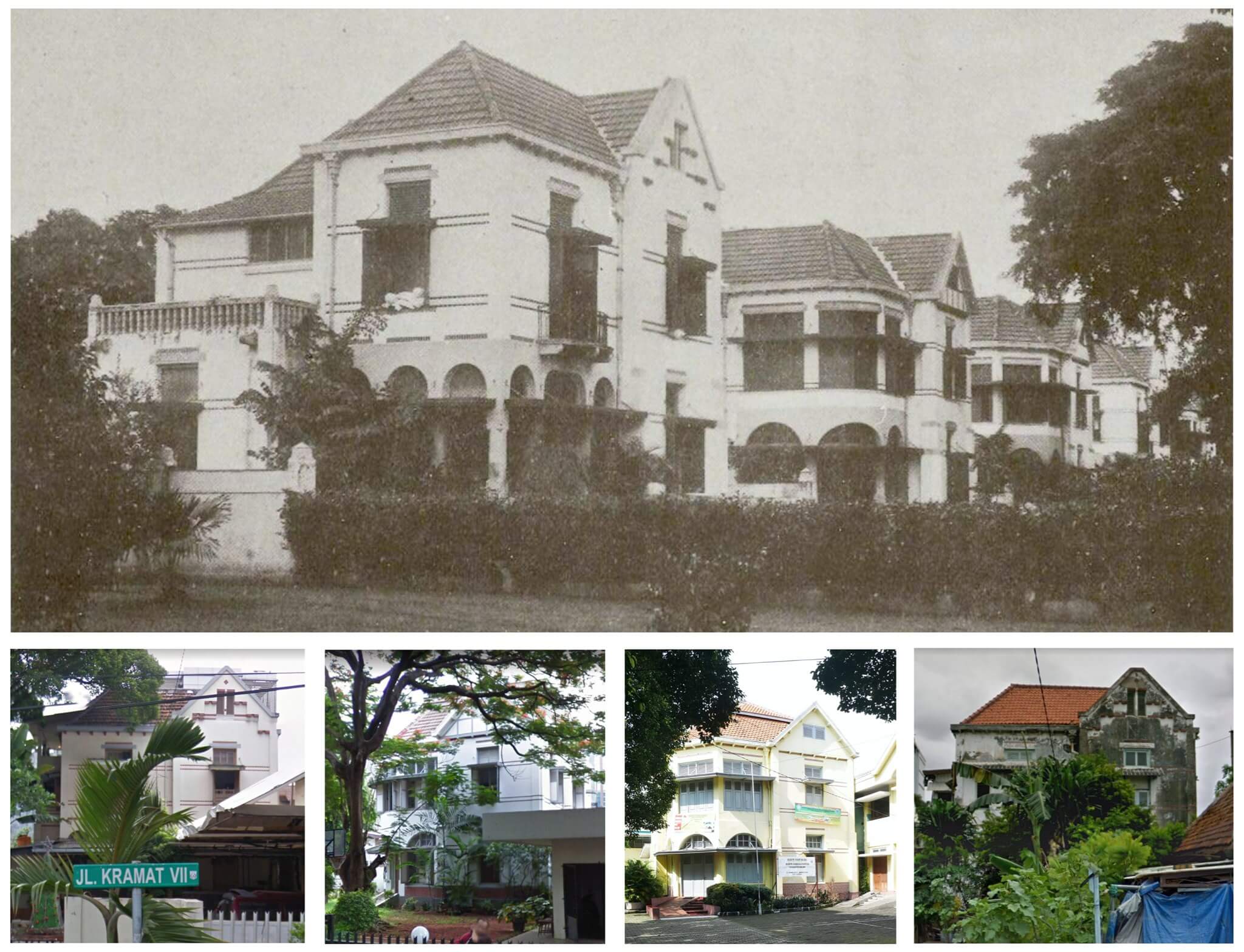
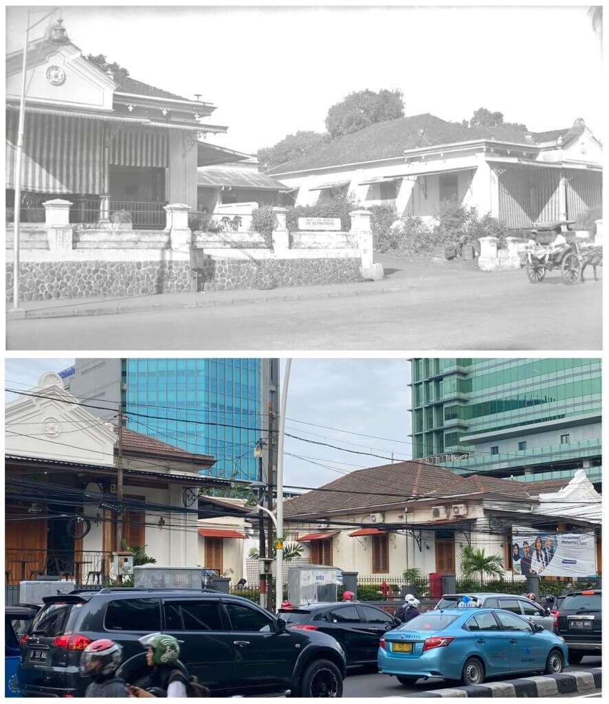
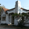
Houses on Jalan Kramat 7 (Laan Wiechtert) in 1912 (above) and now (under)
Most meetings of the Batavia/Jakarta City Council between 1908 and 1911 were dominated by debates and decisions to tackle the city’s severe housing shortage. A newspaper in January 1909 elaborated on the “housing misery” and explained that residential houses in Batavia for middle-income households were too expensive or of poor quality: “Often residents with a small or medium income have to search for houses beyond their buying power or are forced to live in the kampungs”. In 1908 the ‘Bataviaasche Bouwmaatschappij’ (Batavia Building Company) was established with the goal to build good quality and affordable houses.
De Bouwploeg
Nearly two years before this company merged into ‘N.V. De Bouwploeg’ and focused on the masterplan for New Gondangdia and Menteng, it started to experiment in Kramat. The company bought a sizeable piece of land that stretched out from Kramatlaan (now Jalan Kramat V) to Salembaplein (now Jalan Kramat VI) and Laan Wiechert (Jalan Kramat VII), all side streets of the main north south Kramat road. On this piece of land were the ruins of the former Kramat Hotel. Architect P.A.J. Moojen (1879-1955), who arrived in Indonesia in 1903 and was partner of the firm Biezeveld and Moojen in Bandung until 1910, had already designed the new dining rooms of Hotel des Indes and Hotel de Nederlanden (1906), the book store of Visser & Co (1907) and the new NILLMIJ head office (1909), all in Batavia/Jakarta. He was commissioned to design 120 new houses along the forementioned 3 streets in Kramat. Moojen used solid materials and most houses featured innovative designs and fittings (more in the next post).
Kramatpark
Despite the luxury appearance, especially those with two-storeys, they were still marketed as affordable. The monthly rental price varied between 75 and 125 guilders for a two-storey house. The Bataviaasche Bouwmaatschappij remained the owner of all houses. Only 22 houses had two-storeys. These were built at the end of Kramatlaan (which was called ‘Kramatpark’ in popular speech but never obtained that name officially) and the end of Laan Wiechert (Jalan Kramat VII), close to the Ciliwung River. A number of these two-storey houses do still exist today, of which four adjacent houses on Jalan Kramat VII (numbers 23, 25, 27 and 29) are the most eye-catching. These four houses are all visible on the historic picture from 1912, and in the same sequence on the four coloured photos of 2014 and 2015. We were kindly alerted by Scott Merrillees that a number of these houses do still exist today. All photos are individually posted in the comments below this post too.
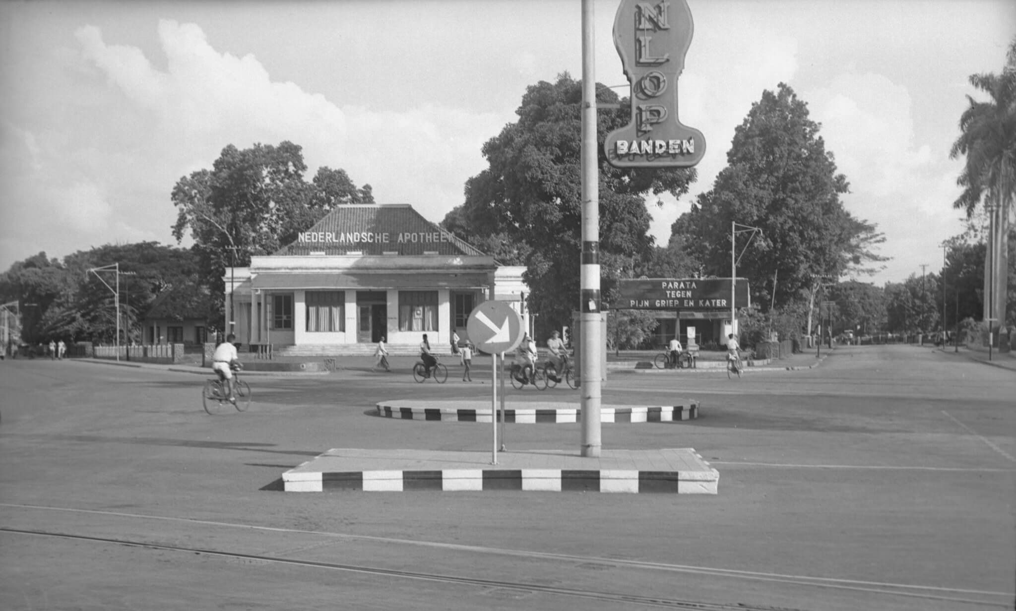
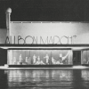
The intersection Simpang Lima at Cikini – Jalan R.P. Soeroso 1941
A unique view of a unique building that stood on this place until at least 1995. During a visit to Jakarta in 1995 I suffered from a tummy bug while staying in a guesthouse along Jalan Gondangdia Kecil. I went to this pharmacy to purchase some Norit and I remember it was still the old colonial era building. This photo from nearly 80 years ago was taken at the so-called ‘Vijfsprong’ where 5 roads came together: Oud Menteng (Jalan Menteng Raya), Tjikini (Jalan Cikini Raya), Oud Gondangdia (Jalan RP Soeroso), Van Heutszplein (Jalan Taman Cut Meutia) and Gang Pengarengan (this road no longer exists).
Nederlandsche Apotheek
We are looking south. Left of the Nederlandsche Apotheek (Netherlands Pharmacy) is Tjikini, to the right Oud Gondangdia. The sign near the drugstore says “Parata, against pain, flu and hangover”. At the front, partly visible, an advertisement for Dunlop tyres. Despite a usual busy intersection, we only see cyclists and pedestrians on this photo. On the site of the former apotik/drugstore is now the “Menteng Huis” with the Kimia Farma Pharmacy and a number of other stores. If any Jakarta residents can tell us more about when the old pharmacy building was demolished, that would be very helpful.
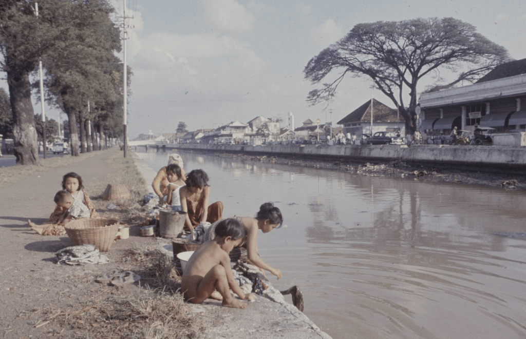
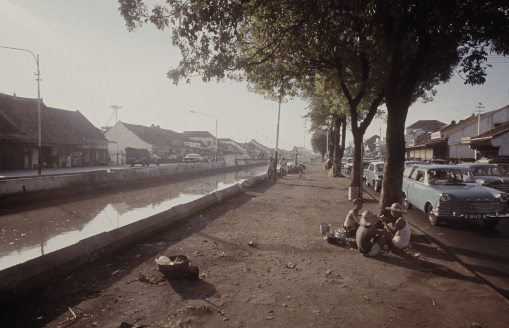
A series of 18 unique pictures, showing Jakarta in November 1965. The photographs were taken by Co Rentmeester (1936- ), a professional Dutch rower who, after he joined the 1960 Summer Olympics in Rome, moved to the United States to study photography at the Art Center College in Los Angeles.
Rentmeester initially started his career as a freelance photographer in 1965 for LIFE Magazine. Between late 1965 and 1969 Rentmeester was in Asia. where he particularly covered the Vietnam war. One of his pictures showed an M48 tank gunner looking through a gunsight. It was selected as World Press Photo of the Year and notably it was the first colour photograph to win the award. He was in Jakarta following the 1965 coup attempt, and also in Hong Kong during the extensive civil disturbances in 1967.
After Rentmeester was wounded by a Vietcong sniper near Saigon, he returned to the U.S. in 1972. His 1965 pictures from a travel through Indonesia were shown in the Van Gogh Museum in Amsterdam, Smithsonian Institution in Washington DC and Asia House, New York. The 1965 photo report of Jakarta shows a city, apparently unmoved by the recent coup attempt.
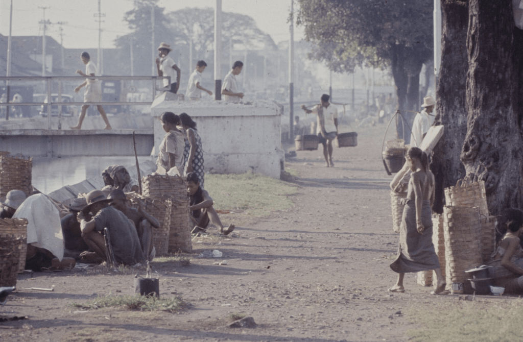
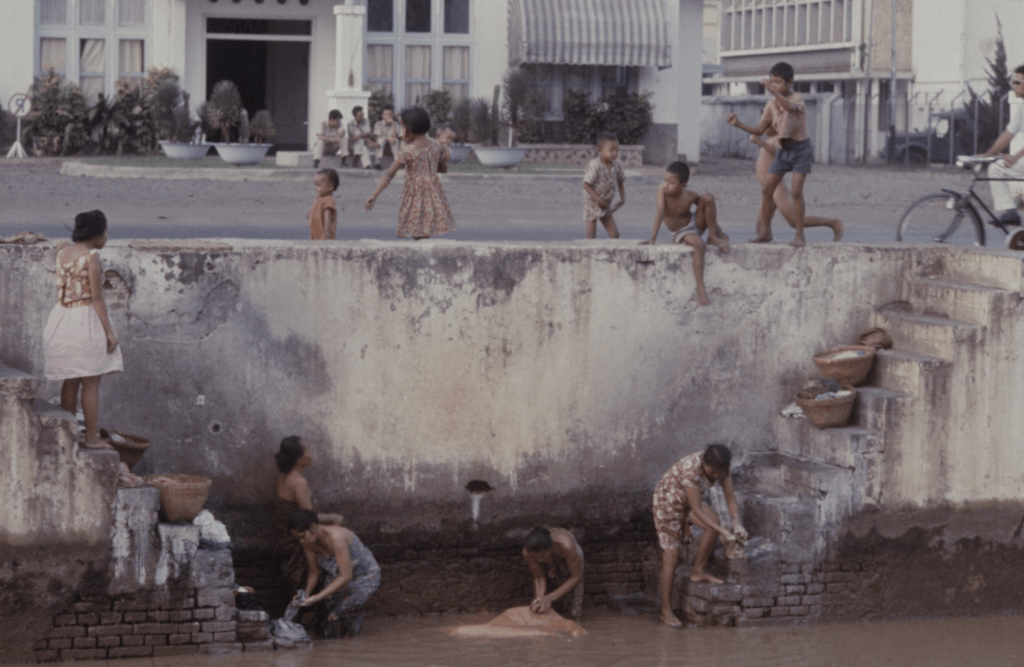
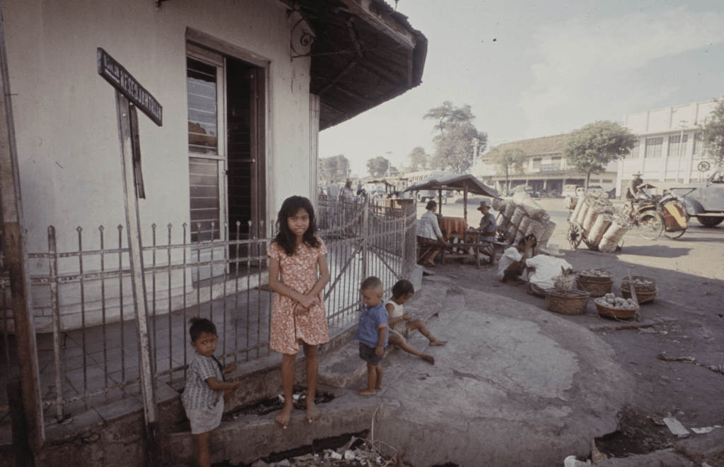
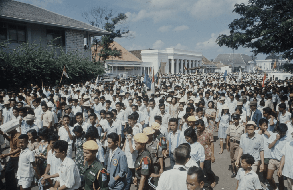
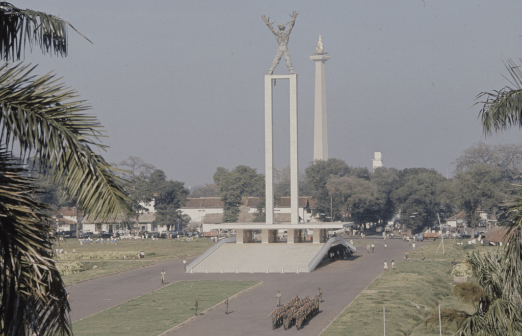
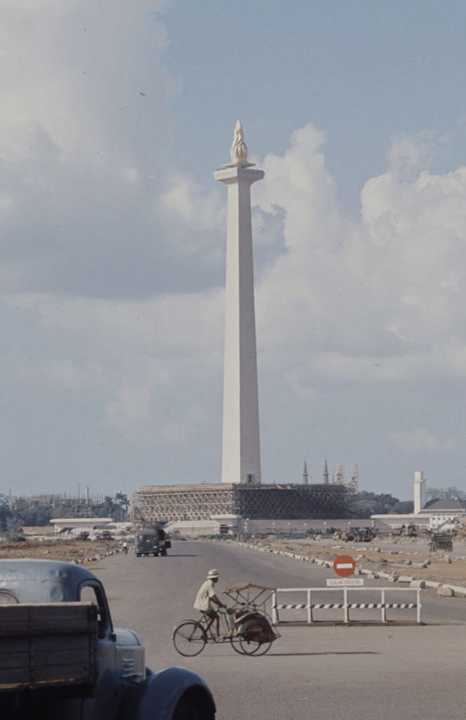
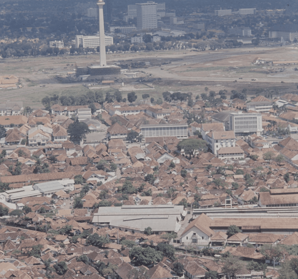
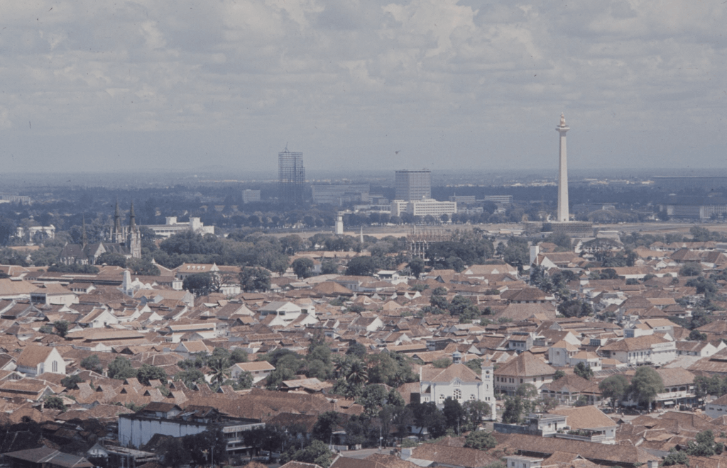
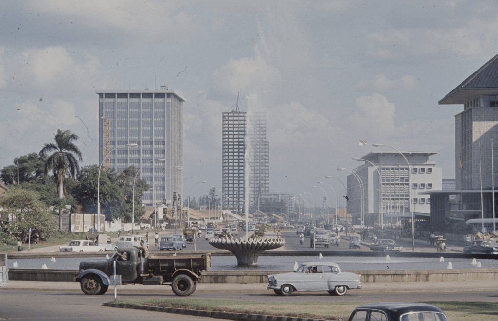
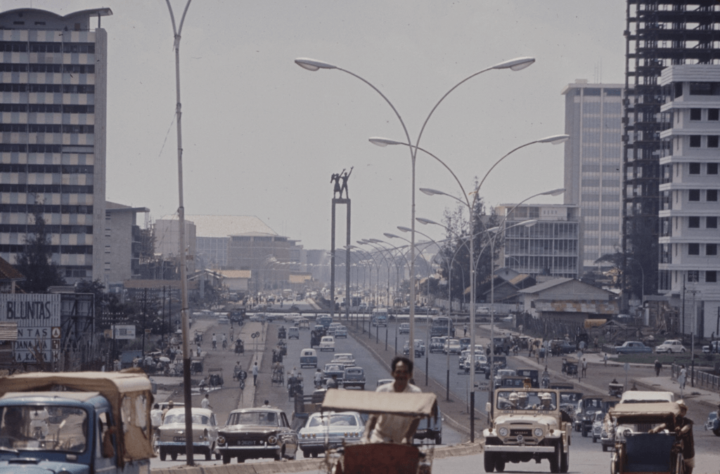
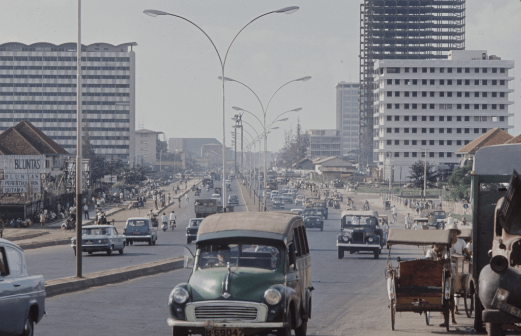
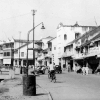
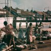
Jalan Hayam Wuruk (left) and Jalan Gajah Mada (right), looking into a southerly direction. We see a group of washing ladies and children on the side of the canal, that was known as Molenvliet in colonial days [source: TIME LIFE].Another view of Jalan Hayam Wuruk (left) and Jalan Gajah Mada (right), further to the south in comparison to the previous picture [source: TIME LIFE].Jalan Hayam Wuruk (right) and Jalan Gajah Mada (left), looking into a northerly direction. Until 1960 a tram line ran on the side of Jalan Gajah Mada, which connected Jakarta Kota with Taman Harmoni, the plain in front of society De Harmonie [source: TIME LIFE].A lot of activity along the side of Jalan Hayam Wuruk (right of the trees). The bridge leads to Jalan Gajah Mada on the left. We are looking into a northerly direction [source: TIME LIFE].The characteristic washing ladies along the former Molenvliet canal on the side of Jalan Gajah Mada, a scene that disappeared from the 1970s onwards [source: TIME LIFE].Close up of the washing ladies and passing cars along Jalan Gajah Mada [source: TIME LIFE].Children posing on the corner of Jalan Gajah Mada and Jalan Kesejateraan, looking north [source: TIME LIFE].A gathering on Jalan Pejambon, looking into a westerly direction. In the distance Gedung Pancasila (the former Volksraad building), with the former Raad van Indië building behind it, and in the far distance we can see part of Gereja Immanuel (former Willemskerk) too [source: TIME LIFE].View from Lapangan Banteng (the former Waterlooplein), with the Irian Jaya Liberation Monument in the front middle. It was unveiled only two years before this photograph was taken. In the distance MONAS, the National Monument on Medan Merdeka. The smaller white tower just right of it, is part of the Pertamina offices (the former BPM) on the corner of Medan Merdeka Timur and Jalan Perwira [source: TIME LIFE].MONAS, the National Monument in the centre of Medan Merdeka. The structure itself was completed in the year of this photograph, although it would still remain closed to the public for another 10 years. We see some scaffolding across the base of the monument. Left of it, in the distance, the Istiqlal Mosque under construction. Behind the monument we also see part of the Jakarta Cathedral, which dates back to 1901 [source: TIME LIFE].An aerial photograph showing the area north of Medan Merdeka, with part of the district Sawah Besar on the foreground. An experienced eye notices Jalan Veteran (formerly Rijswijk) and Jalan Juanda (formerly Noordwijk) halfway towards Medan Merdeka. On the other end of Medan Merdeka, in the far distance, the buildings along the south side of the square in Central Jakarta [source: TIME LIFE].A view from the northeast towards Medan Merdeka in the distance, with the just completed structure of MONAS, the National Monument. In the far distance the skeleton of Wisma Nusantara under construction. On the left centre of the photo we recognise the Jakarta Cathedral [source: TIME LIFE].The roundabout with fountain on the intersection Medan Merdeka Selatan (left), Medan Merdeka Barat (behind the photographer), Jalan Budi Kemuliaan (right) and Jalan Thamrin (in the front). We are looking south with part of the new Bank Indonesia building on the right. On the left the characteristic building which is now the Ministry of Energy and Mineral Resources, but was opened in 1938 as the offices of the Koloniale Petroleum Maatschappij [source: TIME LIFE].Another view of the fountain of the intersection, this time taken from the southern end of Medan Merdeka Barat, looking south with the buildings on Jalan Thamrin [source: TIME LIFE].The southern end of Jalan Thamrin and the start of Jalan Sudirman, with the Welcome Monument in the middle. On the left a part of Hotel Indonesia, opened 3 years before this photograph was taken. On the right side of the photo part of the skeleton of Wisma Nusantara, which would not be completed until 1973 [source: TIME LIFE].Looking along the northern end of Jalan Sudirman towards the Welcome Monument, a bit further south than the previous photograph. Buildings on both sides of this main thoroughfare were still low rise, a sharp contrast with today’s situation [source: TIME LIFE].The Welcome Monument, with Hotel Indonesia behind it. The hotel was opened in 1962, only 3 years before this photograph was taken. In 1965 one could still see becaks in this area of Jakarta [source: TIME LIFE].A lively scene in Jakarta, most likely taken in Kota. We could not identify the exact location of this photograph, however if you know… please let us know! [source: TIME LIFE]
Jalan Menteng Raya 11-13 in 1941 (above) and 2020 (under)
A little gem in today’s Jakarta is Jalan Menteng Raya, in colonial days just known as Menteng or Oud Menteng (Old Menteng). The percentage of heritage buildings that is still present today along this road is much higher than anywhere else in Central Jakarta. On the eastern side of the road are two identical houses of an interesting architecture at number 11 and 13, now part of the Gedung Bina Manajemen.
Architect J.F.L. Blankenberg
The left house at number 11 was in 1941 the office of one of Batavia’s most well-known architects J.F.L. Blankenberg (1888-1958), who was responsible for a number of majestic houses on the Burgemeester Bisschopplein (now Taman Suropati), the house on today’s Jalan Imam Bonjol 1 which is now the Formulation of Proclamation Text Museum and the former NIROM radio studio building on Koningsplein West (now Medan Merdeka Barat). Menteng number 13 was in 1941 the residence of Mr. C.H.R. Landouw. Both houses most likely date from the late 1910s or early 1920s. Apart from some alterations, they are in excellent condition today.
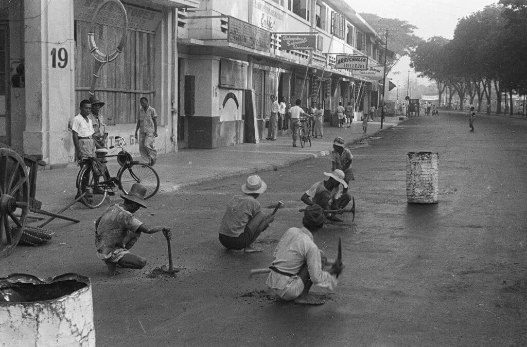
Road workers on Citadelweg /Jalan Veteran 1 in 1948
The condition of most asphalted streets in Batavia/Djakarta after World War II was of a bad condition. During the years of war the Japanese did not invest in maintaining public buildings and streets in the city. Most buildings which were painted in camouflage green in the second half of 1941, did not return in their bright white colours until the second half of 1946 or early 1947. Throughout 1947 and 1948, when it was relatively quiet and the city mostly back under Dutch control, efforts were made to re-install street signs and restore damaged streets and pedestrian paths, like here on the Citadelweg (changed in 1950 into Jalan Segara 1 and now called Jalan Veteran 1).
Renowned stores
We have an interesting view of the street, looking towards the north. On the left on number 19 Rama Stores, which specialised in sports accessories. Number 18 housed the firm ‘Nieuw Holland’. On number 17 Enkfa tailors, where Mr. J. Schonewille was Director. The strip of these three stores is now occupied by Restaurant Dapur Babah. In 1948 there were more tailors further up the street: Arrichiello on number 12A, and Ragusa Frères (Ragusa brothers) on number 9. The tailors Luigi and Vincenzo Ragusa, who owned this store, also started selling ice cream on the annual Pasar Gambir from 1932 onwards, and in 1947 opened a permanent store on Citadelweg 10, next to the tailor shop. Today Ragusa Es Italia (Italian ice cream) is still based along this same street on number 10.